


Anne Braakmann-Folgmann, the lead author of the study published today in The Cryosphere, conducted this research during her PhD at the University of Leeds. Now at the Arctic University of Norway in Tromsø, she highlighted the importance of large icebergs in the Antarctic:
“Giant icebergs are important components of the Antarctic environment. They impact ocean physics, chemistry, biology and, of course, maritime operations. Therefore, it is crucial to locate icebergs and monitor their extent, to quantify how much meltwater they release into the ocean.”
The Copernicus Sentinel-1 radar mission, providing images of icebergs regardless of cloud cover or lack of daylight, is key to this new approach utilising Artificial Intelligence for mapping.
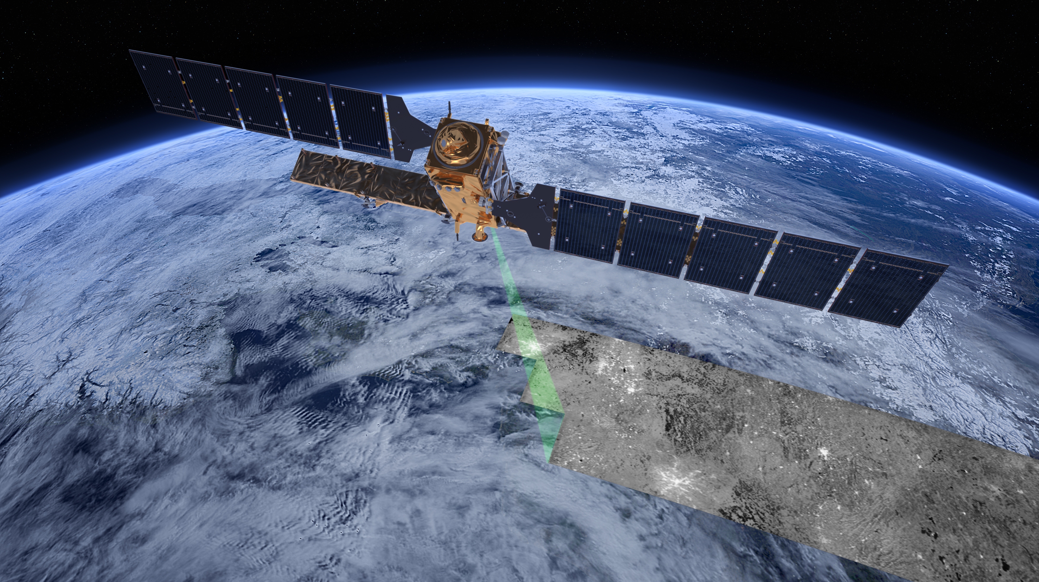
Copernicus Sentinel-1 carries advanced synthetic aperture radar that is being used alongside AI to monitor icebergs. (Credit: ESA/ATG medialab)
In traditional satellite images, icebergs, sea ice, and clouds all appear white, making it challenging to distinguish icebergs. However, in radar images from Sentinel-1, icebergs stand out as bright objects against darker backgrounds. Despite this, differentiating icebergs from sea ice and coastlines in complex surroundings can be difficult.
Dr Braakmann-Folgmann explained the challenges: “We have sometimes struggled to separate icebergs from surrounding sea ice that is rougher and older, and therefore looks brighter in the satellite images. The same applies to wind-roughened oceans.
“Also, smaller iceberg fragments, which occur frequently near icebergs as they constantly lose bits of ice around their edges, are easily grouped together with the main iceberg by mistake.
“In addition, the Antarctic coastline may resemble icebergs in the satellite images, so standard segmentation algorithms often select the coast too instead of just the actual iceberg.”
The newly developed neural network excels in accurately mapping iceberg size, even in these challenging conditions. Its effectiveness lies in understanding complex relationships and considering the entire image context. This precision is vital for monitoring iceberg area and thickness changes, essential for studying how icebergs dissolve and release freshwater and nutrients into the ocean.
The neural network, based on the U-net design, was trained using Sentinel-1 images of giant icebergs. It refines its predictions through continuous training until optimum performance is achieved. This adaptability ensures its success with new examples.
The algorithm was tested on seven icebergs, ranging from 54 sq km to 1,052 sq km, sizes comparable to Bern, Switzerland, and Hong Kong. A diverse dataset, comprising 15 to 46 images for each iceberg from 2014 to 2020, was used, selecting a single Sentinel-1 image per month per iceberg. The results showed an impressive 99% accuracy.
Dr Braakmann-Folgmann commented on the significance of this advancement: “Being able to map iceberg extent automatically with enhanced speed and accuracy will enable us to observe changes in iceberg area for several giant icebergs more easily and paves the way for an operational application.”
Mark Drinkwater of ESA acknowledged the importance of satellites in monitoring remote regions and congratulated the team on their machine-learning approach to monitoring changes in the Antarctic.
Demonstrating and tracking climate change
The ability to track icebergs in a more efficient manner using this neural network also has additional implications for understanding global climate change. As icebergs break from ice shelves and glaciers and melt, they contribute to aspects such as rising sea levels. By closely monitoring the size and melting rate of these icebergs, scientists can gain valuable insights into the rate of sea level rise. Additionally, tracking these changes contributes to our understanding of how climate change is affecting polar regions. Icebergs as an integral part of the Antarctic ecosystem, their movement and melting patterns can indicate broader environmental shifts. This data is crucial for predicting future climate scenarios and developing strategies to mitigate the impacts of climate change.
In conclusion, the University of Leeds’ introduction of a neural network for mapping large Antarctic icebergs represents a significant advancement in environmental monitoring. This technology not only streamlines the process of tracking iceberg size, location, and melt but also contributes to our understanding of climate change and its impact on sea levels. By providing accurate and rapid assessments of iceberg dimensions, this approach aids in the global effort to monitor and respond to environmental changes, highlighting the critical role of technology in addressing climate challenges.
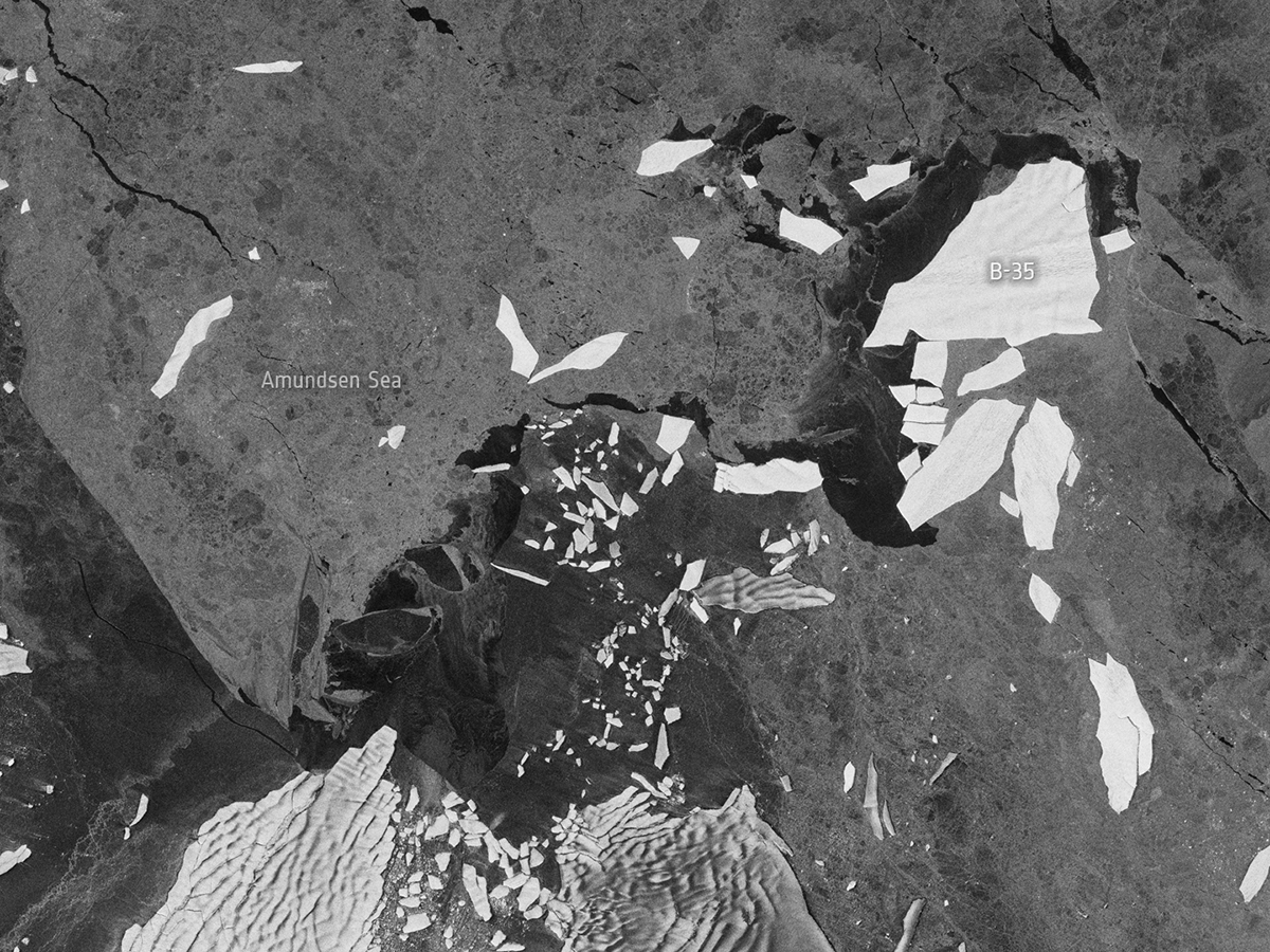
(Article Image Credit: Modified Copernicus Sentinel data (2015), processed by ESA)