


This article originally appeared in the Jan’23 magazine issue of Electronic Specifier Design – see ES’s Magazine Archives for more featured publications.
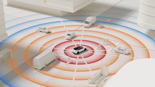
Flying drones could take over life-threatening tasks such as cleaning windows on skyscrapers or cleaning electricity pylons without remote control – only with the help of artificial intelligence in conjunction with increasingly better position-determining sensor technology.
Conventional GNSS receivers could not do this despite the constant development and improvement of GPS, Beidou, Galileo, or Glonass systems. Depending on the current satellite constellation, the position determined can be off by several metres even under otherwise good conditions.
This is fatal for situations in which greater precision is needed. In agriculture, for example, if the autonomously driving machines were to fertilise three metres next to the actual row of plants or remove branches completely instead of by a few centimetres, this would result in considerable harvest losses and thus monetary losses.
When it comes to sensors for determining position, optical and acoustic methods usually lose out to electromagnetic waves. The technology has countless advantages and has now become affordable for most applications. As of Bluetooth 5.1, new positioning functions are available with Angle of Arrival (AoA) and Angle of Departure (AoD).
With UWB or Wi-Fi, this has been known for some time as a Real-Time Location System (RTLS). The main disadvantage so far has been the cost-effectiveness of the hardware setup required for this.
Radio protocols such as ANT or the attachment of RFID transponders can also be an interesting solution. Especially for outdoor applications, however, satellite-based systems have proven to be the best, as most alternative technologies are not suitable or financially unattractive for many applications due to the changing location and insufficient precision. With the increasing areas of application in new markets such as smart farming or robotics, the prices of high-tech solutions for centimetre-precise positioning are also gradually falling.
RTK error correction brings all exactly in position
Land surveys would no longer be conceivable without navigation satellite systems. If a location precisely determined by surveying is defined as a reference station and the position is then determined with a GNSS receiver, it is possible to precisely determine the GNSS error from the deviation.
If the sky is analysed from this location, much data on the current satellite constellation and the angle of refraction to the hemisphere is obtained. This determined data can be considered valid without significant deviations in a radius of about 50km. Only at greater distances would the viewing angles to the satellites or the thicknesses, and thus refraction angles, of the atmospheric layers change noticeably.
If a mobile object within the 50km radius now receives this precisely determined position error from the reference station, it can apply the known error to correct the measured GNSS position. The result would be a position fix that would have only one to two centimetres of uncertainty instead of the usual three to five metres. This results in completely new fields of application for AGVs in agriculture and logistics or aerial drones, for example.
Error correction through time-synchronous transmission of a known reference error is called Real Time Kinematic (RTK). Depending on the application, customers can get access to the nearest reference station from commercial RTK/CORS network providers such as SAPOS, APOS, AGNES, or RTK Clue (further examples can be found at https://rutronik-tec.com/available-cors-networks-in-europe-to-cooperate-with-unicore-gnss-modules/) – advantageous for flexible locations.
Alternatively, own bases can be set, which is more target-oriented in the long term for constant areas of use, such as in agriculture: most farmers have their fields within 50km, which is why equipping the farm with a GNSS receiver and transmitting the position error online makes sense. On the fields, the tractor would also determine the position via GNSS and have the determined error offset locally at the farm via mobile radio.
In the case of the usual rental of special machines in the agricultural sector, which are used on foreign fields yesterday in Bavaria, today in East Frisia and tomorrow in Poland, the service of external Continuously Operating Reference Stations (CORS) network operators must be used. Those, like mobile phone providers, have set up their base stations close enough and monetised access to them.
SoC or module? Not every solution fits all
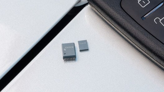
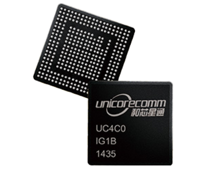
With Unicore Communications, Rutronik provides such RTK-capable GNSS solutions on its linecard. The basis of the portfolio of navigation modules, boards, devices, and kits are the semiconductor chips produced by Unicore itself: The UFirebird UC6226, for example, is a standard GNSS system-on-chip (SoC) with particularly low power consumption. RTK solutions, on the other hand, are based on the Nebulas-II UC4C0, a SoC with a more powerful multi-core computing unit and support for Galileo, QZSS, Glonass, Beidou, and Navstar GPS. A design based on such a GNSS SoC is very demanding and is only recommended for experienced high-frequency design houses.
In a module or board, high-frequency processing, filtering, and signal amplification are already implemented and shielded as well as possible against external influence on the surrounding circuit parts. Corresponding pre-certifications shorten the development time, minimise the risk and save investment costs.
Accordingly, they are the better option for most planned applications. The UB4B0 is such a multi-system GNSS high-precision board based on the Nebulas-II SoC. 432 channels provide enough space to evaluate received signals and use the best ones for position calculation. RTK accuracy is specified as 1cm +1ppm horizontally and 1.5cm +1ppm vertically. In addition to the serial interface for NMEA-0183 communication, an Ethernet interface, USB (Host & Device), a 1PPS signal output and a connection for the optional use of an external clock signal are also available.
The board also features fast polarity detection of the carrier phase and multipath interference detection. The UB4B0 is suitable for participation in the Ground-Based Augmentation System as well as for integration in CORS networks. The module is already used in many surveying and mapping devices with the highest technical demands, which require particularly high precision.
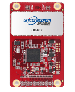
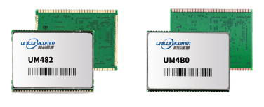
In addition to the 100x60x11.4mm module, Unicore Communications offers the UB4B0M, a more elaborate miniature version with dimensions of just 46x71x9mm – without compromising on functionality or performance. At 46x71mm, the UB482 is also suitable for use in small installation spaces. Both heading and positioning data can be output simultaneously at up to 20Hz. The UB482 is already working in professional moving applications such as agricultural machinery and UAVs.
With the module variants of the GNSS boards, the particularly high-frequency-crit[1]ical circuit parts are already built and pre-certified. Only the customer must add the surrounding periphery. The UM220-IV NV module, which is AEC-Q104 and IATF16949 certified, is based on the UC6226 SoC and, thanks to integrated MEMS and odometer support, is also suitable for dead reckoning navigation, for example when navigating through tunnel systems.
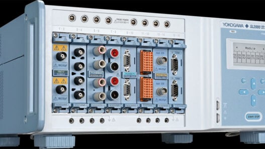
A selection of low-power standard GNSS modules is also available, as well as development kits for all variants. Ready-built receiver boxes in metal housings are also available and can be connected directly to a laptop and not only serve to quickly set up your own CORS base station but can also be used for field tests or product evaluation purposes.
When it is all about the cm +/-: State-of-the-art meets wireless competence
Rutronik is convinced of the importance of Real Time Kinematic (RTK) technology and the positive impact it has on rapidly developing target markets such as AGVs, drones, robots, and smart farming. RTK is increasingly predestined to replace standard satellite receivers, as results with higher precision offer a decisive competitive advantage – even if the technology requires a slightly higher investment despite falling prices.
Together with Unicore, the Rutronik Wireless Competence Centre not only offers the latest solutions, but also individual product and system consulting, which additionally sheds light on antenna concepts, power supplies and radio data transmission of the correction values. Rutronik can draw on the portfolio of around 250 other electronics suppliers, enabling it to put together a complete GNSS system from a single source for each specific application – from Xeon high-performance servers to cloud-based device management with optional geofencing rules and status LEDs.
As early as 2005, Rutronik set up the Wireless Competence Centre to be able to offer customers with the development of mobile radio and GPS applications technically competent support. Over the past 17 years, there have always been between two and four suppliers of GNSS receivers on the broadliner’s linecard, all of whom have endeavoured to provide the best possible training for the product marketing and FAE team.
In 2019, the distributor invited its customers to the European Space Operation Centre (ESOC) in Darmstadt, one of the European Space Agency’s (ESA) operations centres, where they were given insights by Galileo engineers into the technology, maintenance, and expansion of the European system, as well as learning interesting backgrounds on how to work with the GPS, Glonass, and Beidou teams. Why multi-GNSS receivers can determine their position faster than GPS receivers in urban canyons is now just as clear as the lower TTFF power consumption after a long time out.
Both the start time and the power consumption could possibly be further optimised with the help of an Internet connection, for example by downloading the ephemeris and almanack data packets from a server instead of from the satellites via mobile radio. However, these tuning measures have no influence on the error value of the determined position.