


Discover how agricultural drones reduce waste, improve irrigation efficiency, and deliver data-driven insights for modern farming operations.
Modern agriculture is facing operational difficulties, such as water shortages, a lack of labourers, and increased prices of fertilisers and fuel. The agricultural sector remains the largest water user, taking about 72% of the total freshwater withdrawals worldwide (Food and Agriculture Organization of the United Nations, 2025).
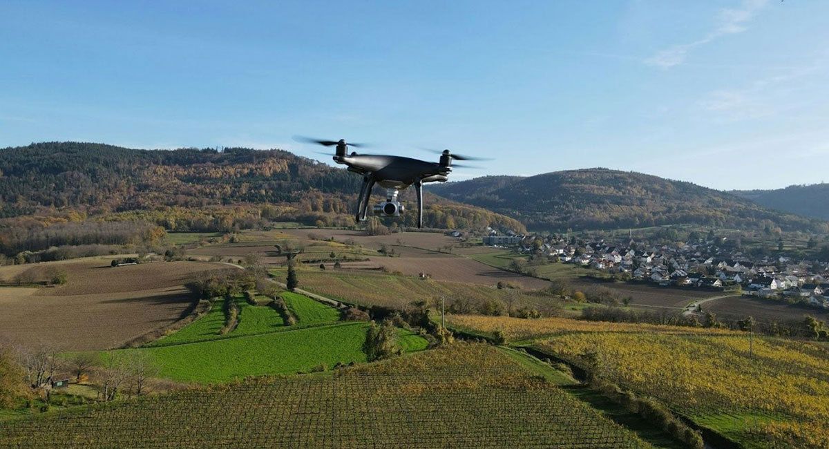
Drones have been adopted and are now among the operational tools field-proven to meet these agricultural challenges. It benefits agricultural farmers in combating the abovementioned challenges by saving time, monitoring crop health, and reducing waste.
The utilisation of aerial technology driven by efficiency is transforming construction and infrastructure inspections, causing agriculture’s reliance on-demand aerial intelligence.
According to Grand View Research (2024), the agricultural drone market will expand from $3.37 billion in 2025 to over $21 billion by 2033. Thus, these devices are to be the co-workers contributing to the productivity sustained despite margin pressures.
What are agricultural drones and how do they work?
Uncrewed aerial vehicles (UAVs) for agriculture are drones that have specialised sensors and imaging payloads that let them collect data from above crop fields. These systems turn raw photos into useful information by using a combination of UAV platforms, thermal/multispectral sensors, and data processing software.
The exact UAV mapping and drone inspections are utilised in construction and infrastructure sectors, proving the versatility of aerial data collection. These tools provide detailed field views without deploying large ground teams, allowing fast health evaluation of crops and soil.
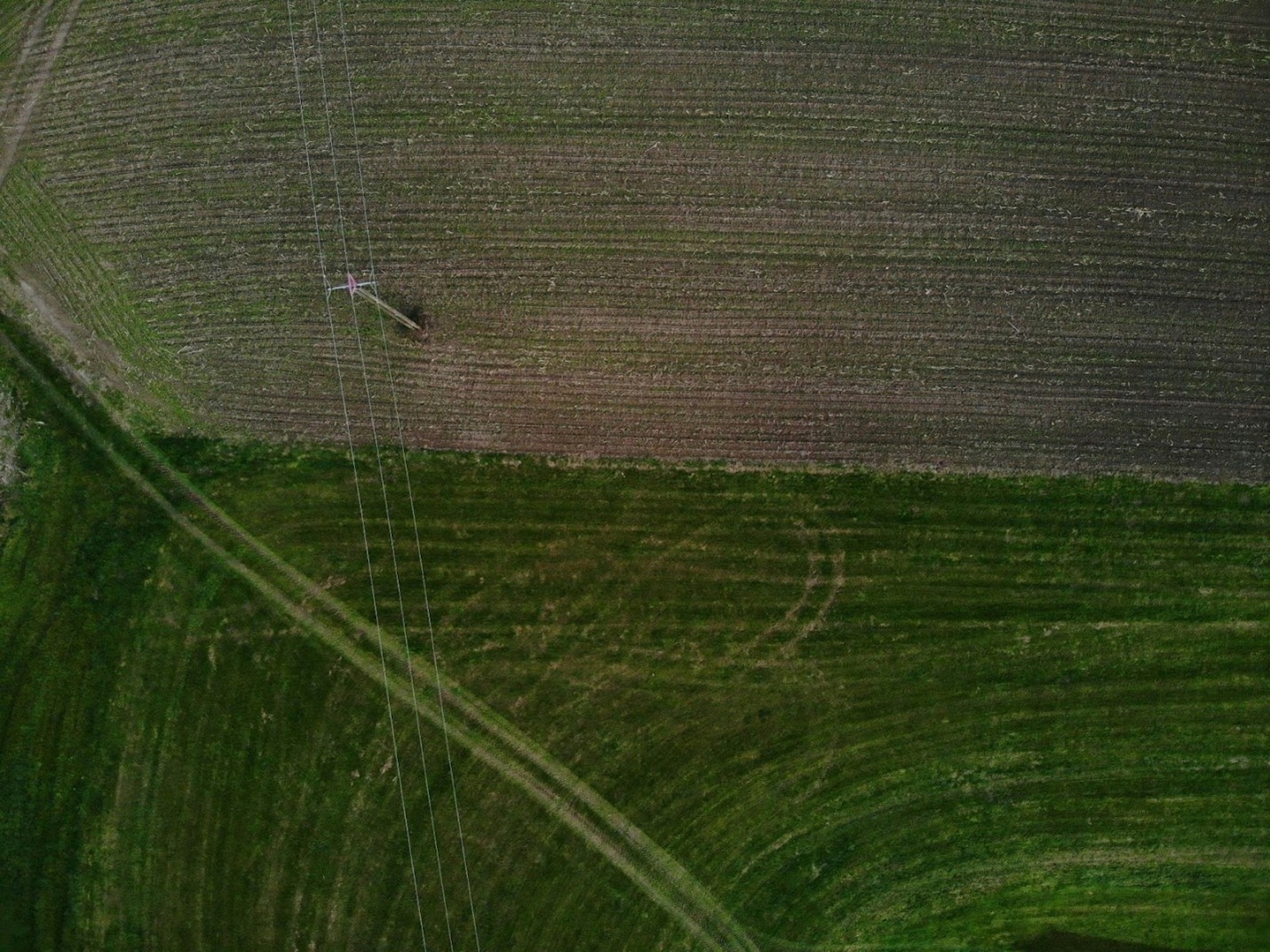
Identifying irrigation issues and reducing water waste
Irrigation monitoring drones with thermal imaging impact inspections by revealing areas with uneven moisture, leaks, and dryness invisible to ground-level inspection. Accuracy in agriculture is crucial, considering the consequences of poor irrigation and water management can cause up to 30-60% water waste (Kjelgren, R., L. Rupp and D. Kilgren. 2000).
Drone-supported surveys offer numerous advantages over traditional manual field inspections:
- Speed: drones are capable of surveying extensive agricultural regions more rapidly than groups of farmers, reducing the time required by an average of 75%
- Labour efficiency: the implementation of drone technology has resulted in the conservation of thousands of work hours through the automation of routine daily operations
- Targeted action: identifying specific regions with water shortages enables the implementation of more efficient water management strategies that benefit the environment and are cost-effective
Early detection of pest damage and crop stress
Early detection is key to minimising crop loss. Precision agriculture drones capture multispectral images to detect stress induced by diseases or parasites that are unnoticeable. This precision is advantageous, as specific outbreaks may result in a reduction of 20 to 50% if left untreated.
By applying drone data analytics and pest detection drones, managers will be able to carry out treatments selectively. Drones have been utilised for precise spraying, and the results are:
- The amount of chemicals used was reduced by as much as 40% (Guebsi, Mami, & Chokmani, 2024)
- Water consumption for spraying activities reduced by up to 90% (Helim, Ram, Borah, & Tengli, 2025)
Surgical interventions have less of an effect on the environment than blanket applications.
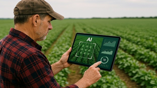
AI-assisted analytics mainly work by turning data into useful insights, helping farmers find and target specific issues.
Saving time by monitoring field operations
Drones possess advanced features like LiDAR, thermal imaging, and multispectral sensors. These features help farmers monitor crop progress, harvest activities, and even entire farmlands from the air, increasing operational efficiency.
Aerial monitoring decreases physical site visit time by up to 60% (Guebsi et al., 2024), which allows field managers to manage crops efficiently and effectively.
Similar to construction progress monitoring, these aerial inspections provide an aerial perspective, eliminating physical visits that are time-consuming.
Why managed drone operations are often more efficient than ownership
There is no doubt that having an in-house drone programme is undeniably beneficial. Even with these improvements, several challenges persist, such as the need for pilot training, drone maintenance, and adherence to FAA regulations.
Commonly, enterprise drone services offer a scalable alternative to the costs of keeping in-house drones (e.g., training/hiring certified pilots, maintaining drones, etc.)
When flight operations, data processing, and regulatory responsibilities are factored in, outsourcing drone operations is often more cost-effective, as managed agricultural drone service providers deliver consistent data quality without the overhead of pilot certification, fleet maintenance, or compliance management.
Technologies behind agricultural drone operations
Several key technologies power modern UAVs:
- Thermal imaging: it provides irrigation diagnostics by giving a visual representation of heat and moisture patterns to determine water stress or irrigation leaks
- LiDAR: it produces detailed maps in 3D of the ground that provide data on the structure of the canopy and drainage evaluation
- Multispectral sensors: they can capture light that is beyond human vision, which is then used to produce indices that detect the lack of nutrients
- Digital twins: virtual replicas of farmland that support long-term planning and yield forecasting through integrated data analytics
These tools have helped improve crop yield predictions, make better use of resources, and plan for the long term. UAV mapping takes data from different sensors and turns it into geographical datasets. It allows users to compare data from different seasons and search for movements.
The adoption of these technologies will enable farm managers to move from timely observation to continuous, data-rich insights.
Compliance, data security, and enterprise readiness
The growing use of commercial drones necessitates aviation compliance and secure data handling as an integral part of enterprise readiness. The regulations, for instance, require licensed drone pilots, safety drone protocols, and FAA Part 107 in the US.
Moreover, proper data security measures ensure no unauthorised person can access sensitive information, such as yield models or irrigation maps. In late 2025, the agricultural sector reported a massive 101% rise in cyber incidents, emphasising the need for strict data handling security.
The future of drones in sustainable agriculture
The future of agricultural drones is leading to autonomy and BVLOS (Beyond Visual Line of Sight) operations. Such technologies are in line with the sustainability objectives – input reduction, producing less pollution, and effective land management.
Currently, approximately 32% of agricultural drone applications employ AI-powered imaging to autonomously identify inconsistencies and assist in forecasting (Global Growth Insight, 2025). This technology enables producers to monitor crops more effectively and to make management decisions based on data.
According to Market Report Analytics (2026), this technology’s market size is expected to be around $3.37 billion in 2025 and $21.59 billion by 2033. It indicates a CAGR of 26.5% for the whole period of the forecast.
Conclusion
Drones have become very beneficial in cutting down waste, saving time, and making data-based decisions for individuals in agriculture. The agriculture sector is transforming into a high-tech, precision-oriented industry just as the construction and infrastructure sectors have.
The ability to control from an aerial view becomes a foundation of sustainable and productive methods of inspection in agriculture. Aerial data is increasingly integrated into daily work processes.
Many farmers and companies in today’s agribusiness industry now rely on aerial data from drones. As the need to optimise farming processes keeps growing, more farmers worldwide are now turning to drones.
About the author:

Hamza Shuaib is an independent analyst specialising in agricultural technology, UAV operations, and precision farming. He writes about how drones, AI, and sensor-rich systems are transforming modern farming practices and operational efficiency.