Test suite enables simulation of location based services in UMTS networks
The LoCation Services (LCS) Test Suite to support simulation of location services in UMTS networks has been unveiled by GL Communications. The LCS architecture in UTRAN follows a client/server model with the positioning functionality distributed across UMTS nodes such as, Radio Network Controller (RNC), Stand Alone Serving Mobile Location Centre (SMLC), Mobile Serving Centre (MSC), Home Location Register (HLR), and Gateway Mobile Location Centre (GMLC).
The Gateway Mobile Location Centre (GMLC) acts as the server node providing information to external LCS Clients.
Says Karthik Ramalingam, a Senior Manager for Product Development at the company, “Location estimation in UMTS network uses Positioning Calculation Application Part (PCAP) protocol over IuPC interface between RNC and the Stand-Alone SMLC (SAS). PCAP consists of Elementary Procedures (EPs) initiating message and possibly a response message. Following are the functions of IuPC interface: Management of Position Calculation Functions, Management of SAS Centric Position Functions, Management of Information Exchange Functions.”
Location estimation uses hybrid positioning methodologies, may be UE-based, network-based, UE-assisted, network-assisted and/or combination of these methods. The main difference is that the network-based measurements do their calculations at the infrastructure level, while the UE based measurements do their calculations at the device.
Ramalingam explains, “GL’s MAPS LCS Test Suite comprises of multiple products working in tandem to support simulation of location services in UMTS networks. Specifically, to support location services in UMTS network, GL’sMAPS MAP IPsignalling emulator is enhanced to simulate Lg, and Lh interfaces using MAP protocol for estimating the position of mobile devices (mobile phones, wireless personnel, digital assistants and so on) independent of underlying network technology. Added to this is MAPS IuPCinterface emulator to support UMTS IuPC interface procedures between RNC and SAS using PCAP protocol.”
GL's MAPS supports simulation of different Positioning Methods and Position Estimation of a Mobile Stations (MS) in universal coordinates.
The estimate is expressed in terms of the geographical shapes and is composed of the type of shape plus the encoding of the shape itself.
The Location Estimate parameters such as Type of Shape and coordinates can be input through conventional user profiles or can be fetched from a CSV file every time it sends the location estimate to the client. This selection is to be made by the user.These coordinates indicate different position of MS at different intervals of time and report is sent either periodically at specified time duration or at once when requested.
Product Spotlight
APV1111GVY
Panasonic
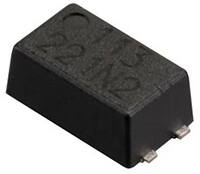
Panasonic PhotoMOS® Photovoltaic MOSFET High-Power Drivers
| SKU: | |
|---|---|
| Stock: | 3490 |
| Cost: | $3.95 |