Will drones be the new face of farming?
Can drones save farmers millions of dollars in just a few minutes? From potatoes to corn, farmers have to manually map hundreds of acres of land if they want any information about their crops. But even then, one bad rainstorm could send 70 hours of work down the drain (and that’s for a small field). But could technology change everything?
DroneDeploy - a drone mapping software startup with the largest drone data platform in the world - which recently used infrared imaging to help a North Dakota potato farmer identify faults in his planting operations, select a flood-resistant strain of potatoes, and save $40m in crop loss.
Here’s how drone mapping is revolutionising farming:
They provide fine grain detail
From estimating crop yield or gauging flood damage to spotting abnormalities in crop planting patterns, drone maps supply much more detailed insights than farmers can manually collect.
They give actionable, same-day insights
Agriculture drones can scout a site in 20 minutes that would normally take days to survey on foot, and generate a detailed map in seconds via the Cloud.
They're capable, high-tech workhorses
Drone 'autopilot' modes minimise sweat and maximise efficiency in the air, letting farmers freely analyse incoming data as their drone flies precise, pre-planned routes.
Click here to read more on how farmers are already using DroneDeploy.
Product Spotlight
APV1111GVY
Panasonic
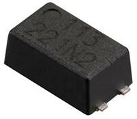
Panasonic PhotoMOS® Photovoltaic MOSFET High-Power Drivers
| SKU: | |
|---|---|
| Stock: | 3490 |
| Cost: | $3.95 |